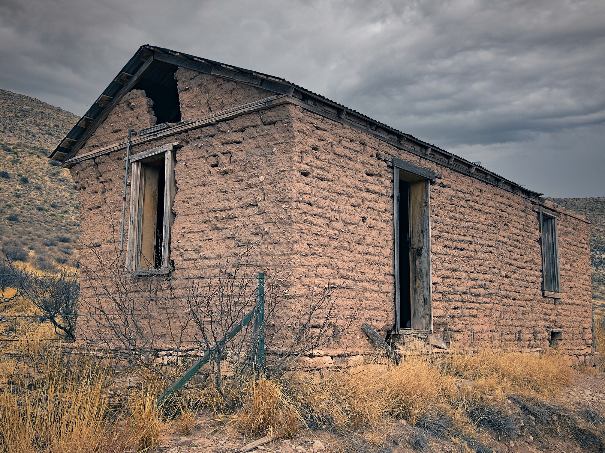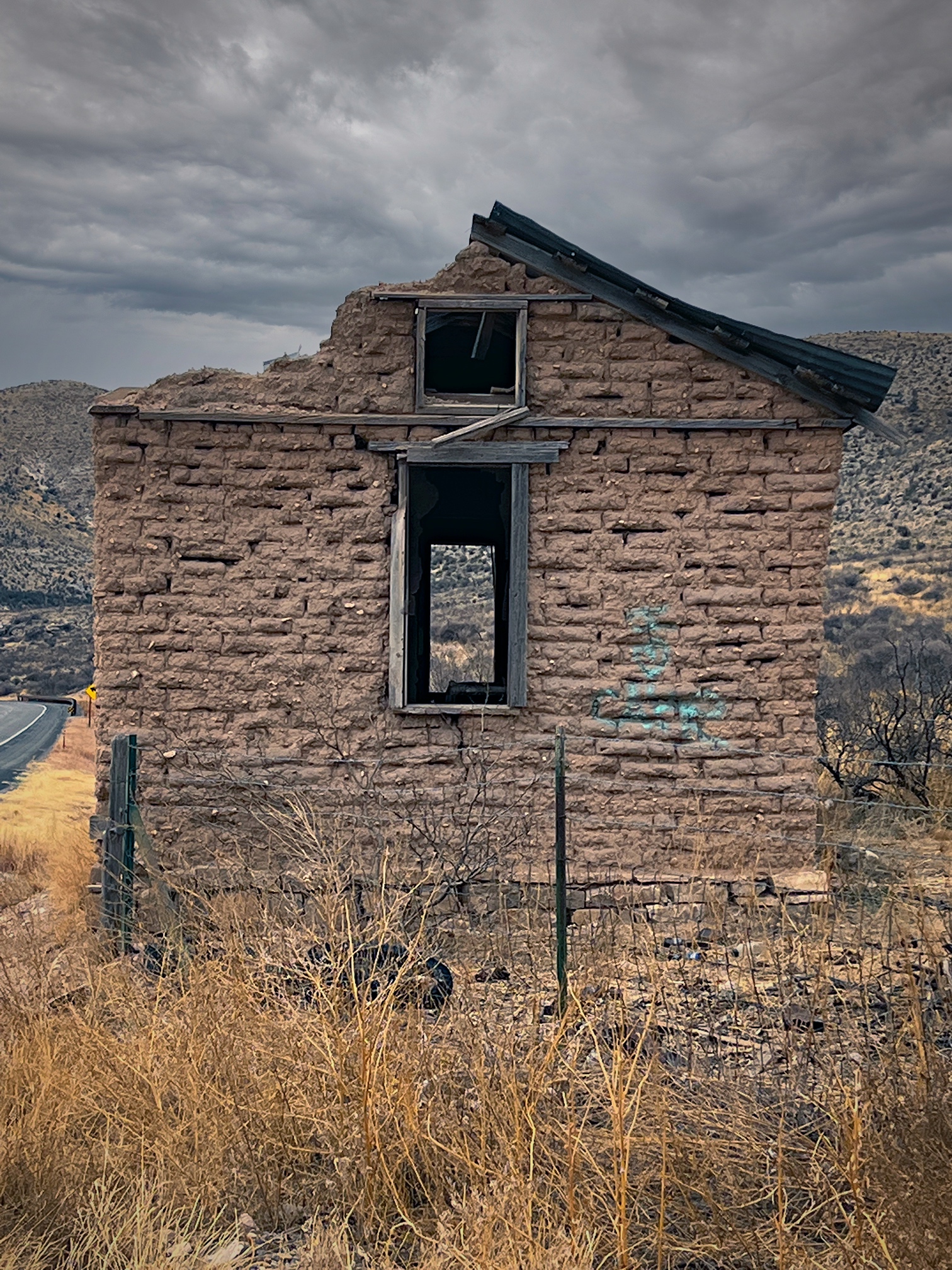
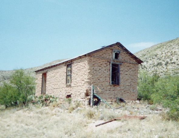
Another perk of having diverted through Roswell is it gave me an opportunity to rephotograph one of the hundreds of abandoned and decomposing structures along the New Mexico highways that I stopped for in 2000.
This little fixer-upper is located at 33° 20′ 24.4″ N, 105° 4′ 27.98″ W, on the north side of State Route 380/US-70 west of Roswell.
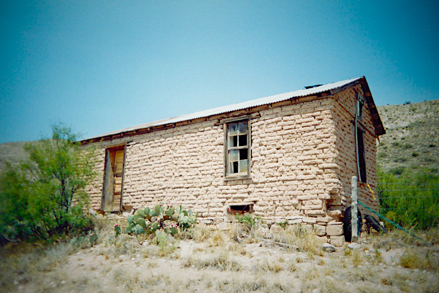
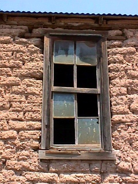
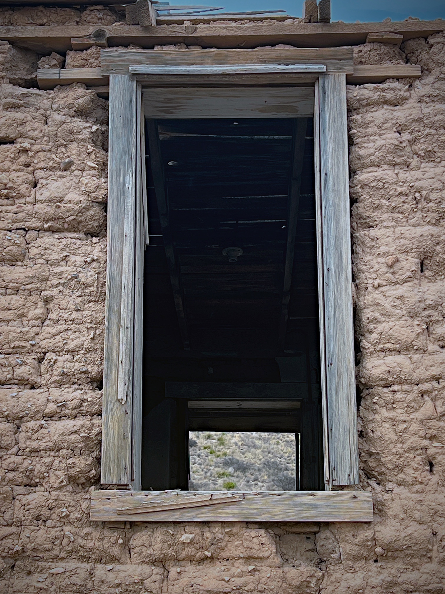
I wanted to recapture this building since when I first stumbled upon it I’d taken most of the photos with a crappy Sony Mavica digital camera (the one that had the 3-1/2″ floppy drive for storage) and the resolution was abysmal. Even the shots I took with my 35mm film SLR weren’t what I was hoping for. So it was time for a do-over.
Amazing what 22 years of technology—and constant exposure to the elements can do.
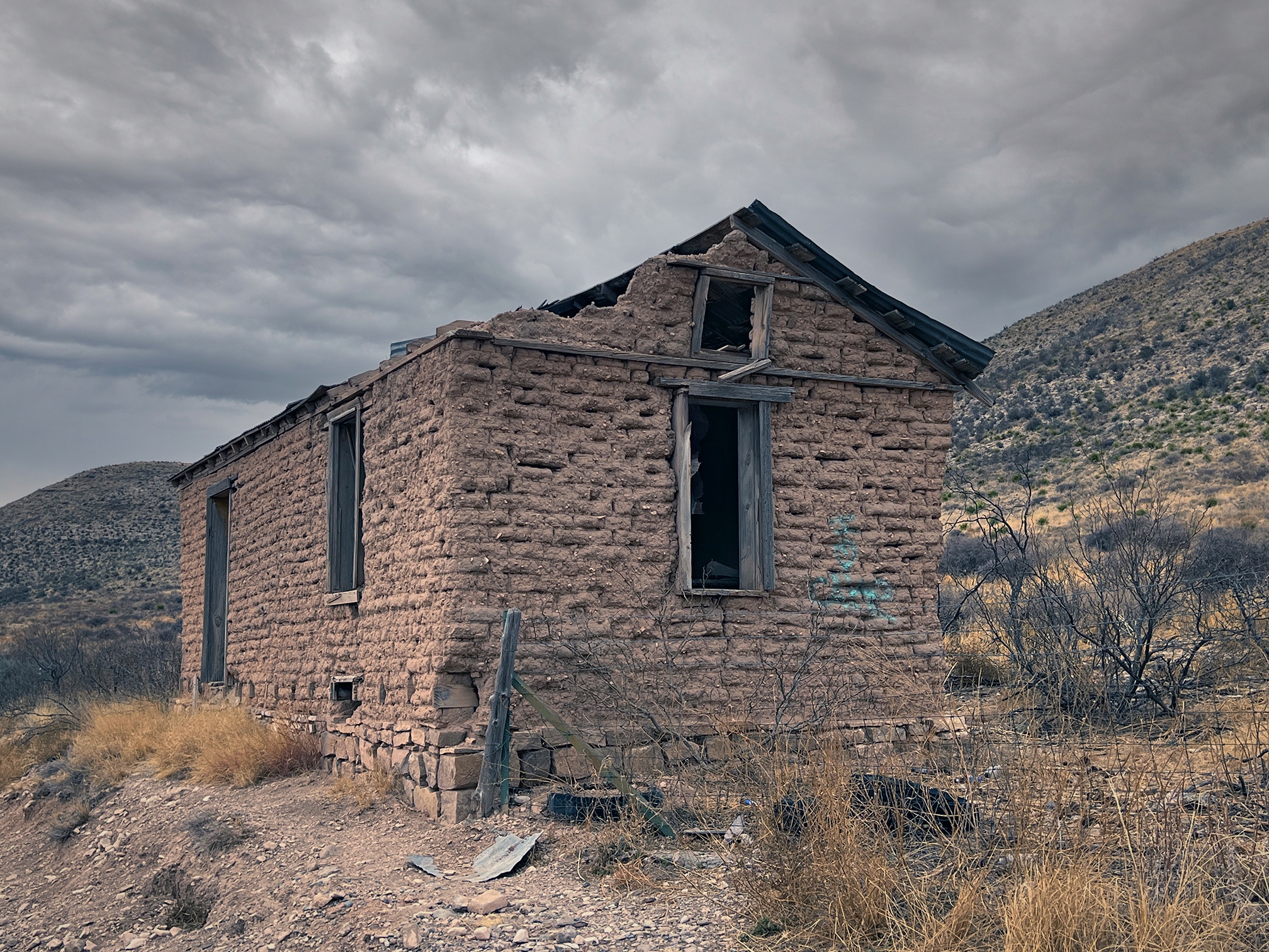
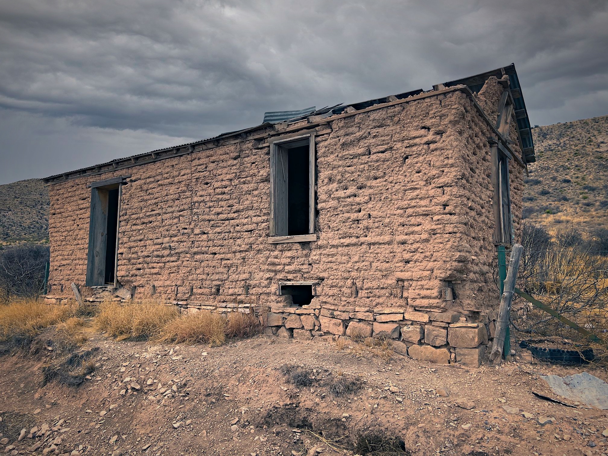
Bonus shots: